Map of Alicante and Its Surroundings
Alicante is a wonderful destination for a sunny city break or as part of a tour through the Valencia region. But where exactly is Alicante located? If you look up Alicante on a map of Europe, you’ll find this lively city on Spain’s eastern coast. The same map shows that Alicante and its surroundings combine urban areas with abundant nature. Thanks to its location by the Mediterranean Sea, the city is also known for its golden sandy beaches and delicious seafood-based cuisine. You can fly there from the Netherlands in about two and a half hours.
Where Exactly Is Alicante?
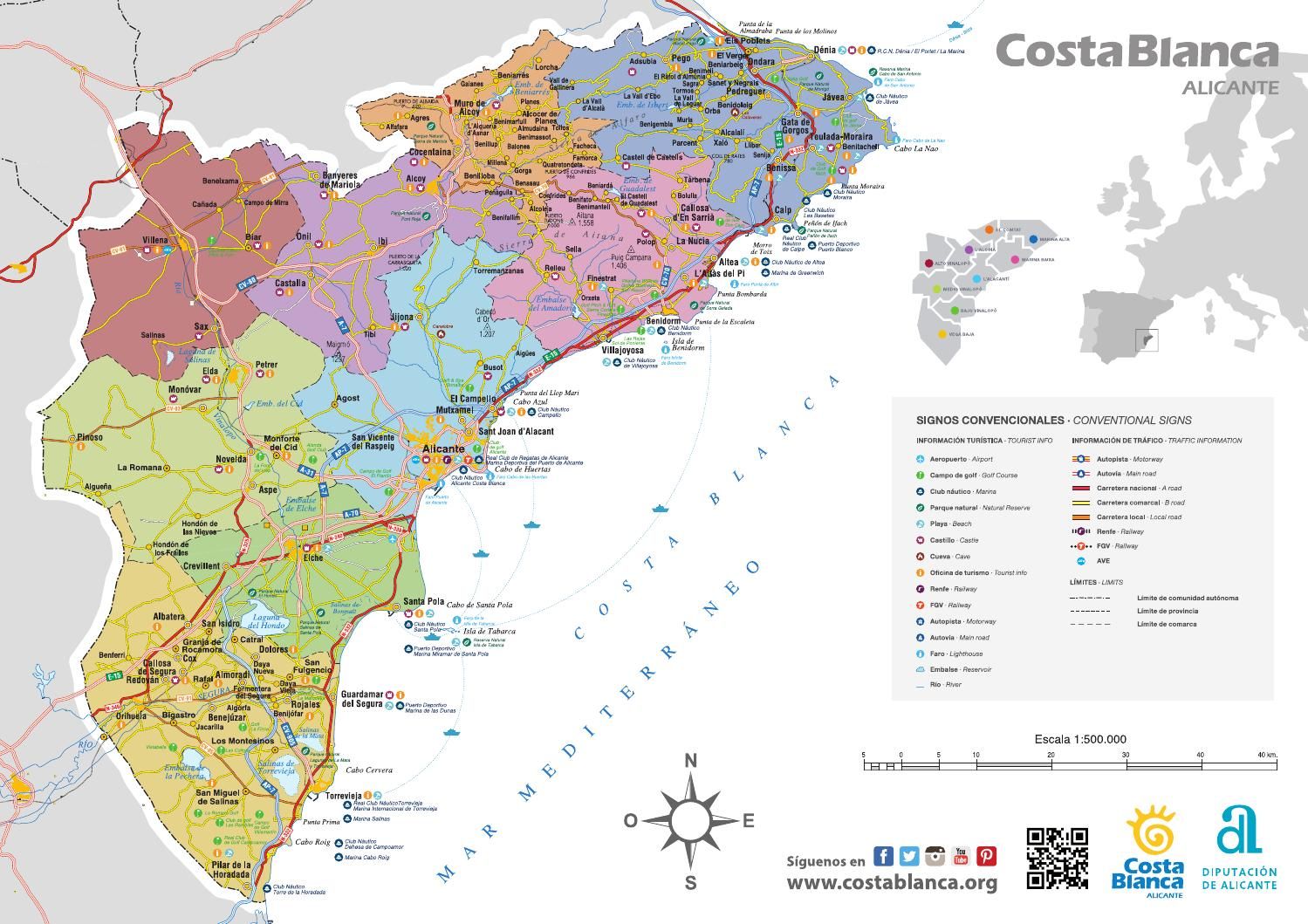
If you look for Alicante on a map of Spain, you’ll quickly see that this authentic city, rich in tradition, is located in southeastern Spain. Alicante is situated on the Costa Blanca and is the capital of this coastal region. The map of Alicante also shows that the same coastal area borders the Murcia region to the south, one of Spain’s most dynamic regions both culturally and economically. The Valencia region borders the Mediterranean to the east and is one of Spain’s most popular tourist destinations, boasting over 200 kilometers of sandy beaches.
Mountains, Rivers, and a Vast Coastline
The question “Where is Alicante?” can also be answered in another way. Geographically, the city has a strategic location. If you look at the map of Alicante and its surroundings, you’ll see that the city is surrounded by mountains such as the Sierra de Aitana, and crossed by the Vinalopó River. This river flows into the Mediterranean, as you can see on the map of Alicante and its surroundings. Of the 200 kilometers of the Costa Blanca’s coastline, more than 60 belong to Alicante and its namesake province, offering a wide variety of beaches and coves for every taste.
The City of Alicante on the Map
When you visit this city, a map of Alicante will also be extremely useful. It allows you to easily locate all of Alicante’s highlights, and it often includes recommended restaurants and cafés. This is helpful not only for the old town and the seafront promenade, but also for the surrounding neighborhoods like El Barrio and Santa Cruz. Often, you’ll gain an additional glimpse into locals’ daily lives and experience the real Spain. Study Alicante on the map and plan enjoyable walking or cycling routes through the city. The city is easy to explore on two wheels, whether by bike, scooter, or motorcycle.
Map of Alicante and the Surroundings
If you stay in Alicante, it’s very likely you’ll also be curious to know what there is to see and do outside the city. In addition to a city map, a map of Alicante and its surroundings will come in handy. When you ask yourself “Where is Alicante?”, the answer is: surrounded by numerous points of interest. Consider, for example, nature reserves like the Parque Natural de las Lagunas de La Mata and Torrevieja, charming white villages perched on hills covered with vineyards, wineries where you can taste local wines, and other large cities like Valencia.
Thanks to its privileged location on the Costa Blanca, Alicante offers a perfect combination of beaches, nature, culture, and gastronomy. A detailed map of Alicante and its surroundings will help you plan visits to the main tourist attractions and discover hidden gems outside the city center. Whether you prefer exploring on foot, by bike, or by scooter, Alicante provides you with all the necessary tools to enjoy an unforgettable experience in this beautiful region of Spain. Get ready to discover everything Alicante has to offer and create lasting memories on your trip!